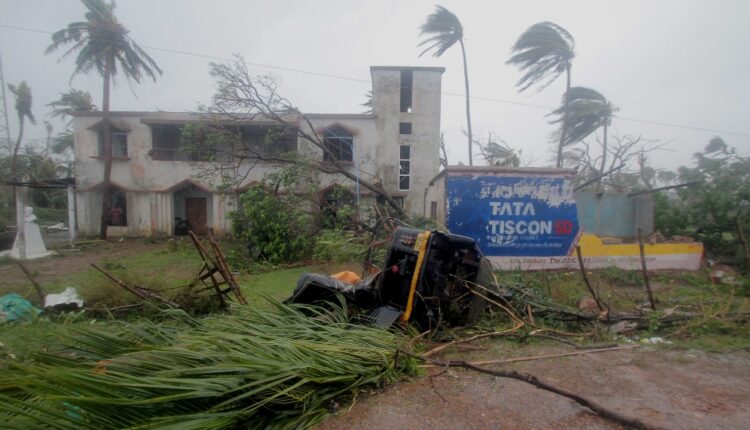
Bhubaneswar: Cyclone ‘Asani’ is likely to make its landfall in East Godavari district of Andhra Pradesh, the India Meteorological Department (IMD) predicted and issued Cyclone Warning for the state today.
As per IMD’s forecast path of the system, the cyclone may make landfall near Katrenikona village in East Godavari district (see pic below).

“The cyclonic storm is very likely to move nearly northwestwards and reach Westcentral Bay of Bengal close to Kakinada-Visakhapatnam coasts by 11th May morning. Thereafter, it is very likely to recurve slowly north-northeastwards and move along Andhra Pradesh coast between Kakinada and Visakhapatnam and then emerge into Northwest Bay of Bengal off North Andhra Pradesh and Odisha coasts. It is likely to weaken gradually into a Cyclonic Storm by 11th May morning and into a depression by 12th May morning,” the IMD forecasted in its bulletin.
On the other hand, the Joint Typhoon Warning Center (JTWC) of the United States predicted that the cyclone may make its landfall near Gudivada in Andhra Pradesh.
The JTWC further forecasted that after landfall, the system may exit back into the Bay of Bengal near Visakhapatnam.
“The cyclonic storm may make landfall within the next 24 hours near the eastern India coast between Gudivada and exit near Visakhapatnam. Once the system finally exits back into the Bay of Bengal, it will encounter warm water. However, it will be offset by a sharp drop in ocean heat content and drier offshore flow with increasing vertical wind shear. The shear will ultimately weaken the low-level vortex as it drifts to the north in the northern Bay of Bengal,” the JTWC said.
The IMD has issued rainfall and wind warning in connection with the cyclone.
Rainfall Warning
- 10th May: Light to moderate rainfall at many places with heavy to very heavy rainfall at isolated places is likely over coastal Andhra Pradesh and rainfall at a few places with heavy rainfall at isolated places over coastal Odisha from 10th night.
- 11th May: Light to moderate rainfall at most places with heavy to very heavy rainfall at a few places with isolated extremely heavy falls is likely over coastal Andhra Pradesh and heavy rainfall at isolated places is likely over coastal Odisha & adjoining coastal West Bengal.
- 12th May: Light to moderate rainfall likely at a few places with heavy rainfall at isolated places is likely over coastal areas of Odisha and West Bengal.
Wind Warning
- Squally wind speed reaching 45-55 kmph gusting to 65 kmph is prevailing along and off Andhra Pradesh coast. It is likely to increase becoming 55-65 Kmph gusting to 75 Kmph from early hours of 11th May and gale wind speed reaching 75-85 kmph gusting to 95 kmph during morning to noon of 11th May along & off Andhra Pradesh coast (Krishna, East & West Godavari and Visakhapatnam districts).
- Squally wind speed reaching 45-55 kmph gusting to 65 kmph is likely to continue along & off Odisha coast during 10th to 12th May and along & off West Bengal coast during 11th to 12th May evening.
Storm Surge Warning: Storm surge of height about 0.5 m above astronomical tide is likely to inundate low lying areas of Krishna, East & West Godavari and Vishakhapatnam districts of Andhra Pradesh.


Comments are closed.