
Weather Alert: Heavy rainfall, thunderstorm in these Odisha dists during next 2 days
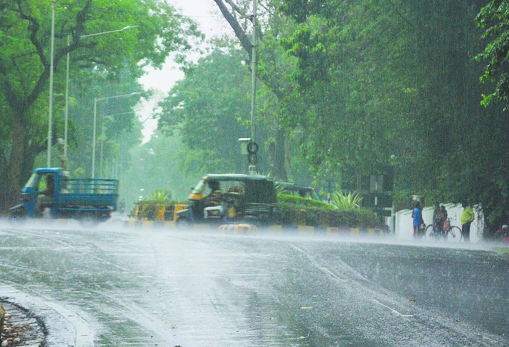
Bhubaneswar: Heavy rainfall and thunderstorm are likely to lash several districts of Odisha in next two days.
According to India Meteorological Department (IMD), the trough from the cyclonic circulation over Jharkhand & neighbourhood to south Odisha at 0.9 km above mean sea level persists. The heavy rainfall and thunderstorm may occur till June 28 morning.
The Regional Meteorological Centre, Bhubaneswar, has issued yellow warning for heavy rainfall and thunderstorm for the coastal, northern and southern districts of Odisha for today and next 2 days.
Weather warning for districts of Odisha for next 2 days:
Day 1 (valid from June 26-27 morning)
Yellow warning: 1. Heavy rainfall very likely to occur at one or two places over the districts of Malkangiri, Koraput, Dhenkanal, Cuttack, Nayagarh, Khordha, Puri, Ganjam, Keonjhar, Mayurbhanj, Sundargarh and Jajpur.
2.Thunderstorm with lightning very likely to occur at one or two places over the districts of Malkangiri, Koraput, Dhenkanal, Cuttack, Nayagarh, Khordha, Puri, Ganjam, Keonjhar, Mayurbhanj, Sundargarh, Jajpur, Balasore, Bhadrak, Kendrapara and Jagatsinghpur.
Day 2 (valid from June 27-28 morning)
Yellow warning: 1. Heavy rainfall very likely to occur at one or two places over the districts of Malkangiri, Koraput, Nabarangpur, Bargarh, Jharsuguda and Sundargarh.
2.Thunderstorm with lightning very likely to occur at one or two places over the districts of Malkangiri, Koraput, Nabarangpur, Bargarh, Jharsuguda, Sundargarh, Keonjhar, Mayurbhanj, Balasore and Deogarh.
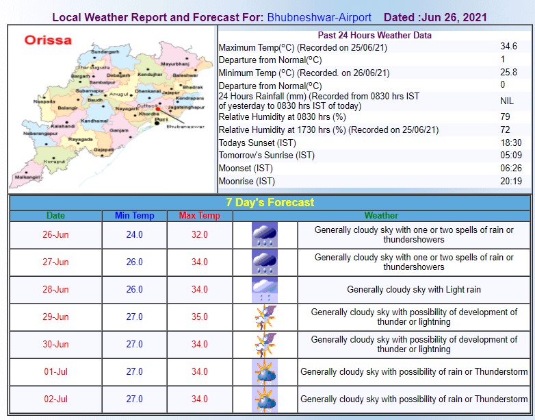
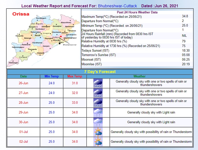
Meanwhile, the Bhubaneswar MeT has predicted thundershower in Bhubaneswar and Cuttack city for 7 days starting from today.
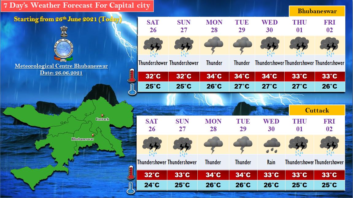
Here’s the weather forecast for Bhubaneswar for 7 days:
Here’s the weather forecast for Bhubaneswar-Cuttack Twin City for 7 days:
Comments are closed.