
Low Pressure over Bay of Bengal: Model hints movement towards Odisha coast
Bhubaneswar: Under the influence of a cyclonic circulation over Equatorial Indian Ocean and adjoining Southwest Bay of Bengal, a low pressure area has formed over the same region while the associated cyclonic circulation extends up to mid-tropospheric levels, the India Meteorological Department (IMD) said today.
The agency was yet to make any forecast regarding the possible path, movement and intensity of the system. Similarly, forecast about the chances of formation of a cyclonic storm was not made, till last reports came in.
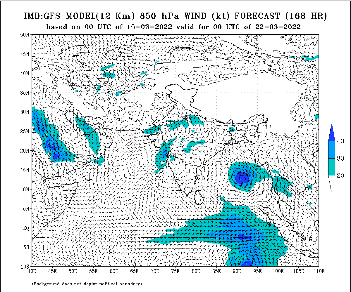
However, the IMD GFS model has indicated movement of the system towards Odisha coast. As per the model, the system might cross the coast around March 24.
Below are the images released by the IMD in connection with the model (for March 22, 23, 24).


Weather expert Surendranath Pasupalak said NCEP GFS model has indicated chances of change of direction of the possible system and it may not strike the coast of India. The country has not witnessed any cyclone in the month of March during the last few years. However, climate change might result in movement of the system towards India coast, he said, adding that a clear picture of the system will come to fore around March 20.
The system will be named as ‘Cyclone Asani’ if it intensifies into a cyclonic storm.
Notably, the Bay of Bengal has hosted as many as six cyclonic storms in the month of March since 1901. Similarly, such storms in April usually head towards Myanmar and Bangladesh. However, the storms also have a history of striking India’s coastline from Tamil Nadu and Andhra Pradesh to Odisha and West Bengal.
Comments are closed.