
Low Pressure over Bay of Bengal in May 2022 to become cyclone? Here’s what models indicate

Bhubaneswar: A low pressure area is likely to form over South Andaman Sea and adjoining Bay of Bengal around May 5 with possibility of further intensification, the India Meteorological Department (IMD) forecasted.
Ever since cyclone ‘Fani’ battered the Odisha coast on May 3 of 2019, development of such systems over the Bay of Bengal in the month of May has become matter of concern for the people of eastern coast of the country.
Cyclonic storms in May usually threaten Myanmar, Bangladesh, West Bengal and Odisha. Such tropical cyclones are known for defying forecasted path of movement, predicted intensity and timeline.
Any tropical system reaching the stage of depression has a fair chance of intensifying into cyclonic storm during this time of the season.
As per IMD, a cyclonic circulation is likely to form over South Andaman Sea and neighborhood around 4th May. Under its influence, a low pressure area is likely to form over the same region during the next 24 hours. It is likely to become more marked during the subsequent 24 hours.
On the other hand, Skymet said that environmental conditions are favourable for intensification of the system into a depression.
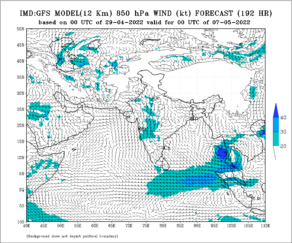
The ‘North Indian Ocean Extended Range Outlook for Cyclogenesis’ issued by the IMD said that the IMD GFS model has indicated northeastwards movement and subsequent intensification of the forecasted system into a depression over Gulf of Thailand.
ECMWF deterministic model has indicated development of depression over east-central Bay of Bengal during the first half of May 5 to May 11.
ECMWF probabilistic model has also indicated 10-30% of cyclogenesis over southeast and adjoining east-central Bay of Bengal during the period.
“There is moderate probability of formation of a depression over South Andaman Sea and adjoining southeast Bay of Bengal areas with gradual northeastwards movement, and enhanced convective activity over south Andaman Sea and adjoining areas of southeast & eastcentral Bay of Bengal, Andaman & Nicobar Islands, Myanmar and Thailand,” the outlook said.
The IMD GFS model has also graphically indicated the formation of the system and northeastwards movement towards Myanmar and Thailand between May 6 and May 9 (see pics below).


Comments are closed.